Where’s the snow? That’s a question many winter enthusiasts are starting to ask, even the folks I know at NOAA and meteorologists are hoping for a little white gold soon as well. This years snow totals to date are about half of last year at this time, but the on the ground levels weren’t much higher than we are seeing now. If you remember last year we saw periods of warm weather followed by a snowstorm, which seemed to be much of the weather last year.
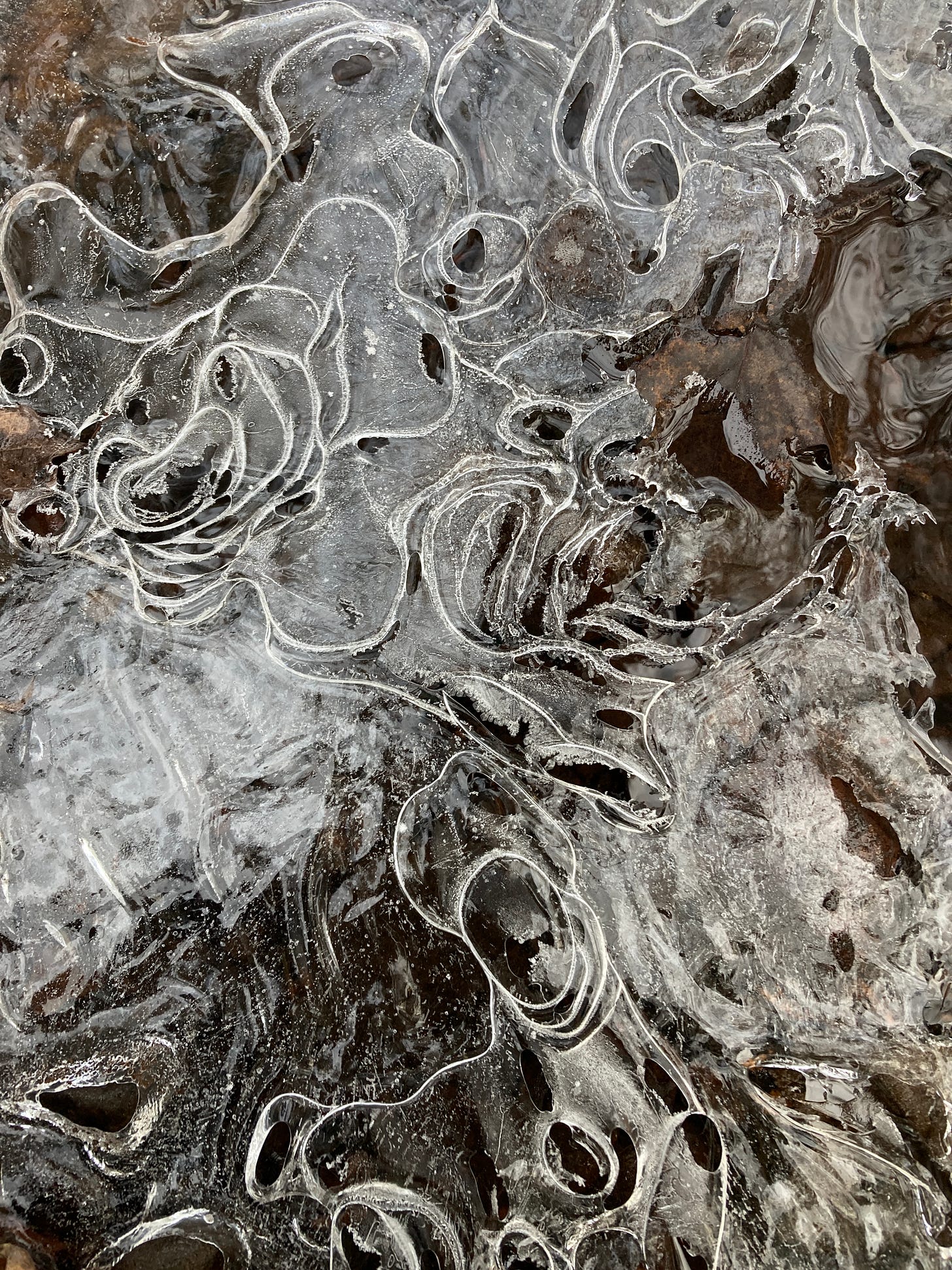
Above: ice formation on a little creek off the Nara Nature trails in Houghton 12.3
The 2020/21 season was a low snowfall year which this season very well could mimic, we didn’t see but a few stations reach just over 200 inches of snow for the season.
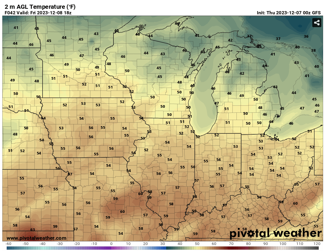
There is hope out there in the 5-7 day forecasting, but there is a lot up in the air with this system moving in. First we have to see some above average temps in the upper 30s and possibly even into the mid 40s across much of the Midwest at least through Saturday night. Right now it is to early to tell whether we will see much lake effect snow, system snow, or mostly rain Sunday into Tuesday. Most of the western and central UP is looking like it might steer clear of the rain, while the eastern UP is taking a turn for seeing precipitation in the form of mostly rain, unless we can see those cool winds drive further east. What we are seeing is that Gulf air moving up into the Great Lakes that may keep things warmer than we like this time of the year here in the UP. Basically the GEFS ensemble looks promising for 4-6 inches of snow across the western UP while the Euro is giving us hints of little to no snow and mixed precipitation across the eastern UP.
Long term through December is not looking good for snow with temperatures above average through most of the month heading into Christmas weekend.
Did the First Top 10 Snowiest Places UP LIVE on Facebook on Monday. Make sure to tune in on Facebook on Mondays, at 5pm all through the winter.
Paying subscribers make it possible for me to do these snow reports, videos, and live drives. Please consider becoming a paid subscriber so I can drive more often away from the Keweenaw and do more snow reports.
Also if you aren’t already I would ask you please subscribe to the FunintheUP Youtube channel
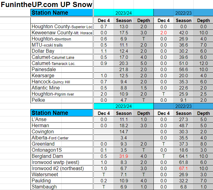
UP Snow Totals Below for Dec 4th and 5th.
T = trace, NR = No report, NA = Not Applicable
If daily slot is 0" the station hasn't updated or recorded no snowfall.
Sometimes a station won't update that day and does the next day or even days later.
Tahquamenon Falls State Park only updates at the end of each month.
Keweenaw county only updates during the weekdays.
Sanderson Field Airport (Soo) updates next day.
Most Snowfall Dec 4th: Houghton east (Pilgrim River) with 2.0 inches
Most Snowfall Dec 5th: Big Bay (EagleMine) with 2.1 inches
Most Snowfall, season to date: Bergland with 31.9 inches
Biggest 24hr snowfall this season: Bergland with 12.3 inches (10.29.23)
The Painesdale snow station numbers are back now, I couldn’t get the data up until today, so now I should be able to get it daily.
NOTE: also some of the stations haven’t been updating this year, you have to realize that almost every station is done by volunteers and many of the volunteers are older. Some people may have passed away, moved, gotten sick or physically unable to measure anymore. Stations come and go through the years.


