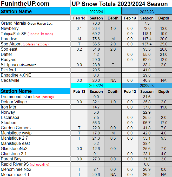
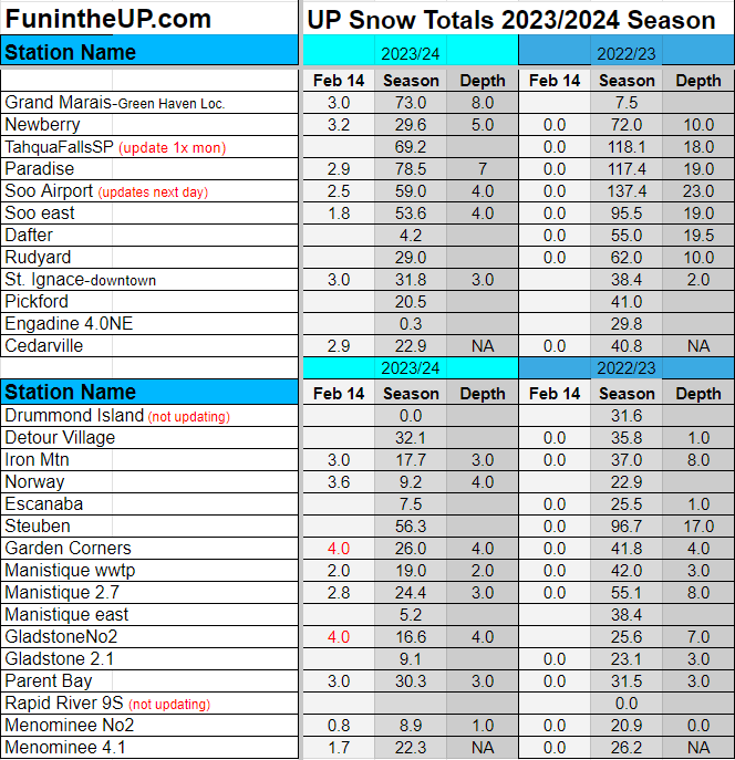
Back to winter for a few days before it warms up again a little. The eastern and southern UP saw the most snow and the higher elevations in Baraga, Marquette, Houghton, and Keweenaw counties.
Friday snow should be minimal before we see some light flurries over the weekend. The south westerly flow should mainly bring snow to the south eastern UP with lake effect off Lake Michigan. Small chances to see a Bayfield Bomber which could bring more than a couple inches to the Keweenaw and Copper Country. Wouldn’t expect more than 4 inches through Sunday.
After Sunday we should start seeing the temps get back into the mid 30s again so enjoy the snow and colder temps while you can this weekend. There is a slight chance we could see a decent snow storm heading into the last few days of February, but we shall see how things develop.
Thanks for subscribing to the Yooper Report. — YooperSteve
Stay tuned for the next UP hiking adventure post soon.
Guided UP Tours, hidden gems, rock picking, waterfalls, photography tours
Memorable adventures away from the crowds - upperpeninsulatours.com


