


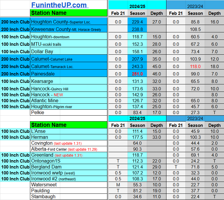
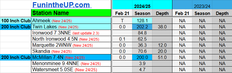
U.P. Snow totals Feb 21-24
Snowstorm arrives Thursday


Todays post is a FREE POST for all so everyone can catch up on the snow totals. I really appreciate you all subscribing and following FunintheUP on the social media channels.
After a week with little to no snowfall it is back to winter at least for the next few days. Last week we have saw temperatures reach the mid 40s and even some places saw low 50s. Snowfall on the ground has dropped 10-12 inches at all of my 6 snow stations in the last 5 days. I am fine with a little warmup here and there during the winter and a little sunshine too. When it comes to this time of the year I either want it to just warm up and all the snow to melt or stay cold and snowy through the middle of March.
This year has been more of a normal snowfall year for most locations across the Upper Peninsula as I’ve pointed out in previous posts. Looking at the data from last year at this time to this year you can see some locations are up 140-150 inches from last year, it goes to show you how little snow we had at this time last season.
The middle of February to the middle of March last year we didn’t see much snow but then we saw some of our biggest daily snow totals to close out March. The month of March last year was the second snowiest month last year at most locations across the U.P. which doesn’t happen very often.

Forecast ahead
Well if you were paying attention last week I was writing that we would have a decent snowstorm to closeout this month, and that is the case. So get excited folks if you like winter because this will help with winter recreation activities.
Thursday-Saturday we will see some cooler temps back around normal for this time of the year, but that won’t last long as the weekend closes out we will see those temps get back into the low 30s and mid 30s in areas.
Middle of next week we could see another storm system move in bringing a bit of moisture from the south west, bringing some rain and wintery mix. Some cooler Arctic air moving in behind the warm air will bring more lake effect snow. I’ll look at this more closely the next few days and see how thing develop, but I think we are in for a good snowy start to March.
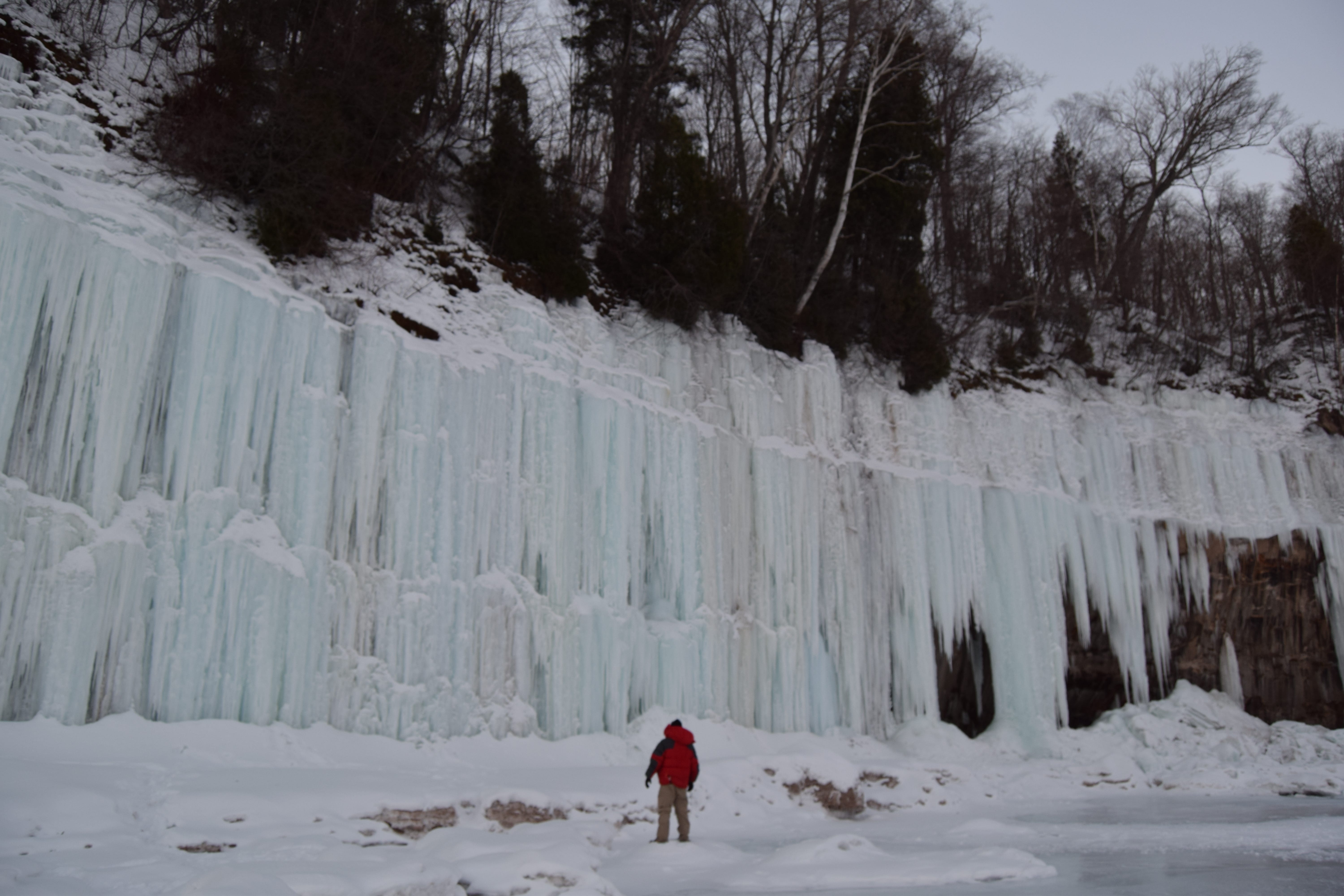
Above: Grand Island Ice caves 2018
Snow outlook Thursday to Saturday morning
Houghton/Keweenaw - 4 to 12 inches higher elevations in NW snowbelts
Ironwood/Bergland - 2-8 inches, areas near Bergland to White Pine may see 4-8”
Ontonagon to Greenland - 2-4”
IronMtn to Escanaba - 2-4”
L’Anse/Baraga - 1-3”
Michigamme to West Ishpeming - 4-6”
Marquette city - 1-3”
Au Train to Munising - 3-5”
Munsing east to Melstrand 4-8”
Newberry/Tahquamenon falls - 3-8”
Soo - 3 to 6”
St Ignace to De Tour Village - 1-2”
Engadine to Manistique - 3-6”


Those pictures from Grand Island ice caves are amazing! I finally figured out my updated email account so I can see emails from your Substack. All our snow here, downstate melted Tuesday when we got to 50 - 55 degrees. I was sad to see it go.