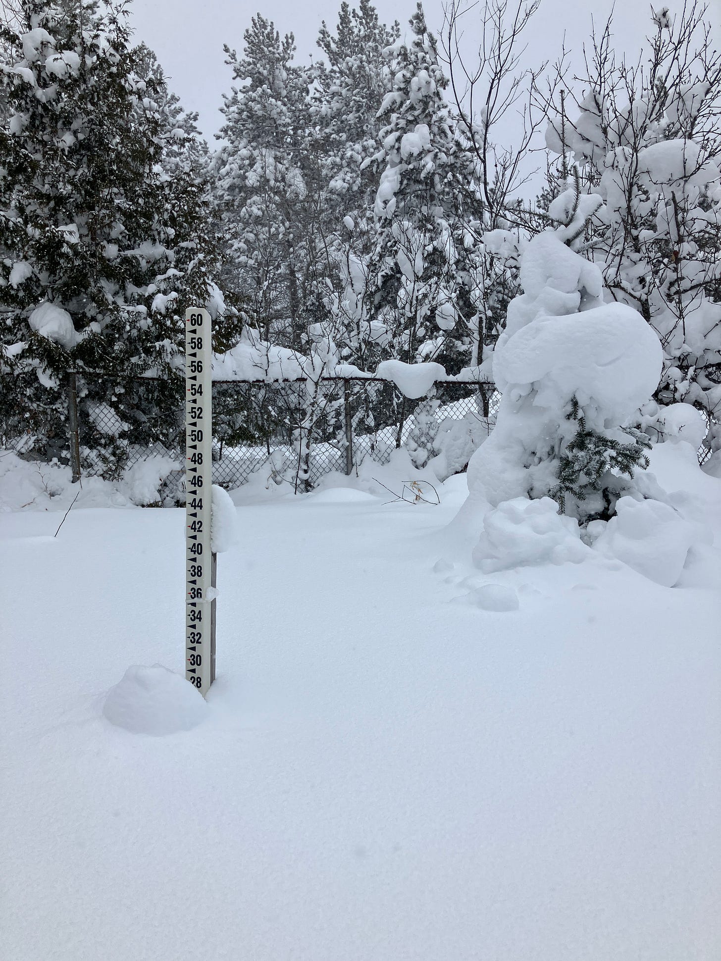
Above: on the ground snow level at Calumet Tamarack loc 1.19.24
The Keweenaw and Western UP saw the most snowfall and now after today the eastern UP will see their snowfall as winds shift north. Temps today were still a bit chilly but slightly higher than they have been this last week. Another cold night with temps rising into the low teens on Sunday.
Snowfall this weekend and into early part of next week should be minimal after tonight’s lake effect snowfall in the N/NW snow belts. Drier air moves in Saturday afternoon which will bring snowfall down to almost nothing through Sunday into Monday. Higher concentrations of snowfall will most likely be those areas of the southern portions of Pictured Rocks to Newberry and areas near Paradise into Saturday morning.
Looking out from Saturday through next week we are seeing an upper pattern consisting of an 500mb trough over the west coast right now. Along the Rockies there’s a ridge and a broad trough over the eastern US. Sunday early morning we will start to see the ridge in the Rockies start to move over into the plains by Tuesday bringing with it warmer air behind it to the Great Lakes.
Above: a little bit of sunshine in the Copper Country 1.19.24
It appears that a Alberta Clipper will be arriving in the Midwest Thursday but it shouldn’t affect the UP in anyway, it looks like it will flow down and be engulfed into the system from the Gulf further south.
Monday night, Tuesday, and into Wednesday we might see some brief N/NW winds which could bring some light lake effect snow, but it doesn’t appear to be a lot right now. Temps Tuesday and into next weekend should remain above normal with little to no snowfall, some possible rains might be possible in the southern UP Tuesday and Wednesday.
I made a post awhile back in December that I would be surprised it we see any snowfall station reach 95-100 inches of snow by Jan 31st, it now appears I will be very close to being wrong on that prediction. It will likely be wrong as there is another 11 days left of January. I am ok with that as I want snow, it is winter, and I like winter activities.
UpperPeninsulaTours - Guided UP Adventures to off-the-beaten-path places.
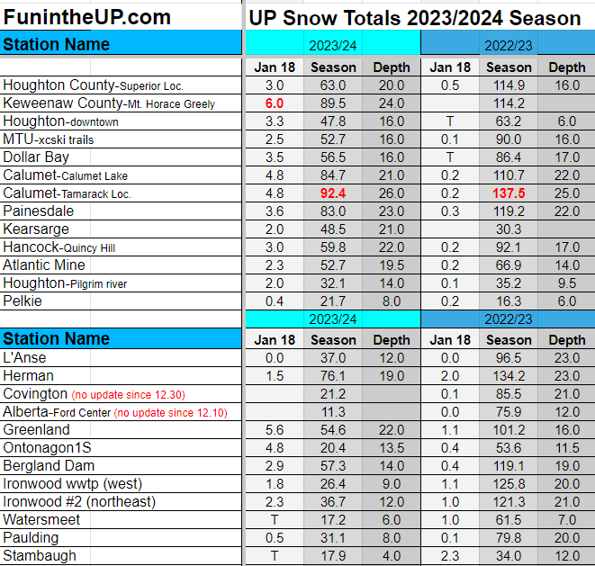
Snow Totals for Jan 18th below.
T = trace, NR = No report, NA = Not Applicable
If daily slot is 0" the station hasn't updated or recorded no snowfall.
Sometimes a station won't update that day and does the next day or even days later.
Tahquamenon Falls State Park only updates at the end of each month.
Keweenaw county only updates during the weekdays.
Sanderson Field Airport (Soo) updates next day.
Most Snowfall Jan 18th: Keweenaw county with 6 inches
Most Snowfall, season to date: Calumet (Tamarack location) with 92.4 inches
Biggest 24hr snowfall this season: Clarksburg with 26 inches (1.12.24)


