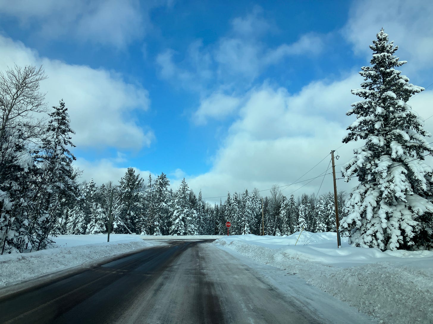
Above: beautiful snowy scene on snowshoe hike with friend John - 1.20.24
Most of the UP saw some snow last night, higher numbers in the upper elevations outside of Marquette and south of Big Bay. Snow as very fluffy today, large snow crystals with lots of air between them. This type of snow really breaks down fast, 10 inches of this type of snow can end up being only an inch of snow overnight as it settles. Most of the snow we saw this past week has been pretty fluffy snow, but this has been the fluffiest. We had some nice lake effect snow bands showing up nicely on the radar image over Lake Superior, check it out below.
Check out the loop from of the clouds over the Keweenaw around the 18th.
Let’s look at the ice coverage over Lake Superior now.
2024-1-20 - 5.19% - Great Lakes total ice 13.80%
20231-20 - 3.01% - Great Lakes total ice 4.39%
So you can see with that cold spell this last week ice coverage grew a few percentages. On Jan 10th, Lake Superior ice was 1.29% and total Great Lakes coverage was 1.07%.
Temps will be above average for much of the remainder of January but we are getting into our annually coldest period of the year about mid Feb to the first couple weeks of March where we usually see ice coverage growing to the highest percentages usually.
So weather ahead isn’t look to exciting, other than a little mixed precipitation Tuesday and Wed with some possible mid 30s before it cools back down towards the weekend.
Above: snowy scene from Airport rd looking at US41 - 1.20.24
A mid level jet will move in on Sunday brining with it winds of 25-35mph. This coming week we will also see some shortwaves heading into the Great Lakes region increasing the chance of some light snowfall, but not before we could possible see those warmer temps.
After this warm weather passes and mixed precipitation leaves the region we should see a pattern change arriving this next weekend when ridging over the western US amplifies bringing with it some cooler air back to the Great Lakes.
Currently tonight here in the Keweenaw and parts of Alger county we have been seeing some moderate lake effect snow, but not expecting it to last to long into the morning. So I should have at least a few places in the UP to update for snow totals tomorrow night.
These reports are made possible because of paid subscriptions which help cover a small portion of my gas money. Thank you for your support.
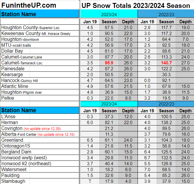
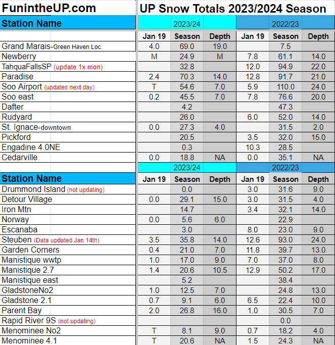
Snow totals for Jan 19th below.
T = trace, NR = No report, NA = Not Applicable
If daily slot is 0" the station hasn't updated or recorded no snowfall.
Sometimes a station won't update that day and does the next day or even days later.
Tahquamenon Falls State Park only updates at the end of each month.
Keweenaw county only updates during the weekdays.
Sanderson Field Airport (Soo) updates next day.
Most Snowfall Jan 19th: Big Bay (Eagle Mine) with 10 inches
Most Snowfall, season to date: Calumet (Tamarack location) with 95.9 inches
Biggest 24hr snowfall this season: Clarksburg with 26 inches (1.12.24)


