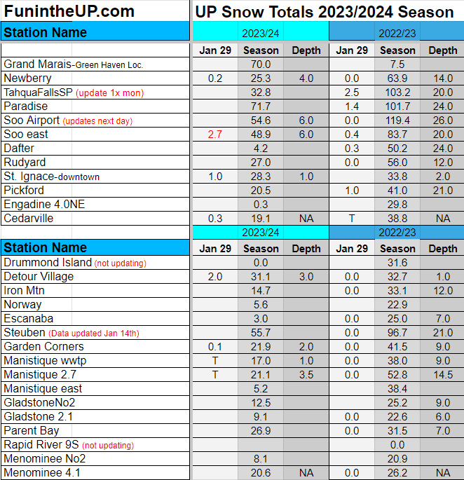
Some light snow across the eastern UP while most of the UP saw nothing to a trace of snow.
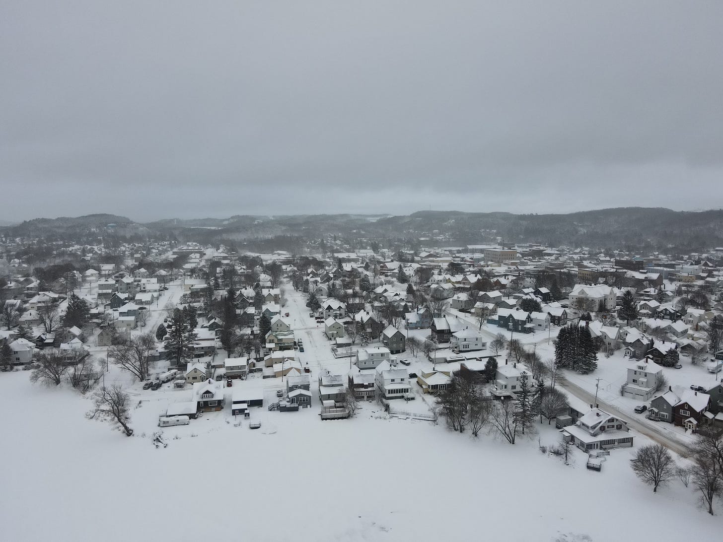
Above: Ishpeming, MI from Jan 16th, 2021
Haven’t seen much snow in the last 7 days a few traces here and there. Been in the 30s for the most part, tonight into tomorrow should remain pretty clear, little cloud cover. We may see close to 50 degrees in some areas in the UP tomorrow, should see snow levels on the ground drop a couple more inches and in some places in the UP might start seeing grass.
If there’s a time to go see waterfalls in the winter it’s during these thaws, especially going into the weekend with the continued warm weather.
Don’t expect much snow for the next 10 days. It isn’t until about Feb 10th-12th when I am expecting the next snow storm but not before we see some more rain. We are approaching our coldest period of the year mid Feb into first week of March and with Lake Superior wide open expect some decent snow should there be any cold Arctic winds.
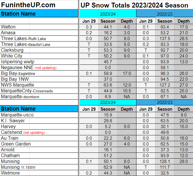
It is looking like my prediction of now stations to reach 100 inches by Jan 31st will hold true, I think I made that prediction back in the middle of December, not something I really thought would hold especially after the Keweenaw kept getting blasted for 8 days straight with lake effect.
Did you enter the UP Snowfall Total Contest this year? It will be interesting, some of those low numbers are looking really good now. Ultimately there will be 1 person who will WIN the 2 Tour Package in the Keweenaw. One FREE Keweenaw boat tour for 2 people with Keweenaw Boat Tours, and 1 FREE Full Day Tour with UpperPeninsulaTours
Thanks for subscribing to the Yooper Report UP Snow Report
UP Snow Totals for Jan 29th below.


