


U.P. Snow Totals Jan 4/5/6
Little snow for the next 5-7 days

Snow is slowly adding up, some places more than others. Considering how little snow we had until the middle of January last year we will take all we can get.

Above: ice volcanoes off Agate Beach 1.6.25
WARNING: ice can be dangerous and weak explore at your own risk
If you are a snowmobiler it’s been a bit tough to find good snow unless you’re in southern Houghton county, eastern Ontonagon county, Alger county, Luce county, Schoolcraft county and parts of Chippewa county. Snow conditions have been rideable but turned pretty rough around Christmas into the New Year and it wasn’t until these last few days when we got another blast of lake effect and colder temperatures that things improved a bit.
Cross country ski trails have improved as well across these same areas. The SISU ski fest in the western UP got cancelled again for the lack of snow that’s how bad it is over near Ironwood and Bessemer for now this season again.
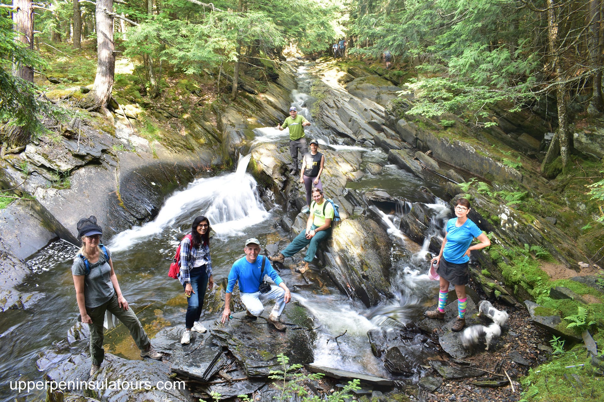
Private Guided U.P. Adventures away from the crowds - upperpeninsulatours.com
Weather Forecast into the weekend
We will see a bit of light lake effect the next couple days, but nothing that warrants any Winter Weather Warnings or Advisories at this time.
The 24hr Kuchera forecast shows most snowfall will be around the Porkies with most of Ontonagon county seeing some snow as well as Southern Houghton county. Looking out east we can see a little snow south of Marquette and much of Alger county and into the Schoolcraft county line area.
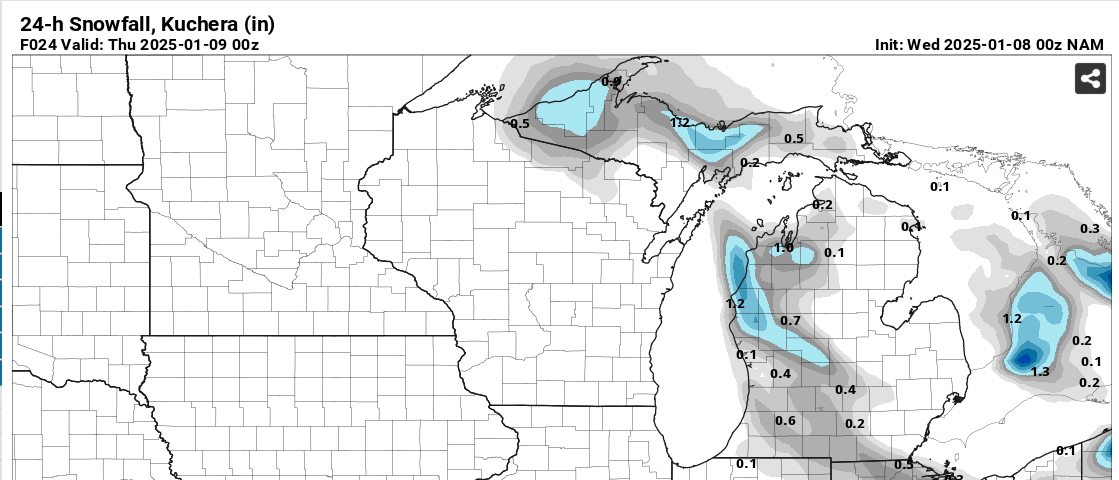
Wednesday night we should see south winds move cloud cover to the north over Lake Superior which should open up opportunities for star gazing, not total clear skies but enough to view some stars. Temps should dip into the single digits across much of the Upper Peninsula especially the western and central UP off of Lake Superior.
Models don’t really show much as far as precipitation into the weekend, but it is around the beginning of the coming week when it appears a clipper will be arriving that should bring snow back into the NW snowbelts. We shall see how things develop over the weekend as clipper arrives and shortwave moves out during the weekend. Cold air lingers and Lake Superior ice coverage is still low so anything can happen.
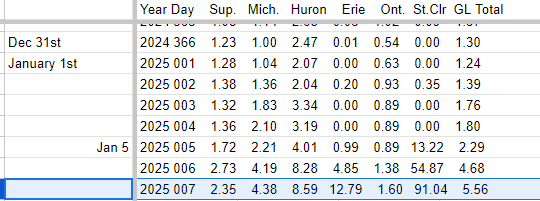
Great Lakes Ice Coverage
Keep reading with a 7-day free trial
Subscribe to The Yooper Report to keep reading this post and get 7 days of free access to the full post archives.