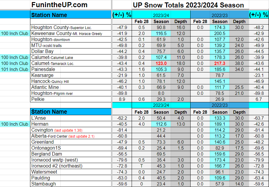
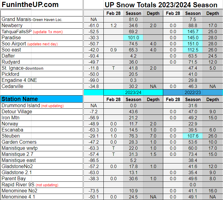
Snow returned for a couple days and dropped an inch in places up to 10 inches in others, but it really wasn’t much to make a difference on the snowmobile trails, with the warm temps coming it’s not going to get better that’s for sure.
Today wasn’t as cold as it was yesterday with temps in the mid teens and slowly rising into the mid 20s by early evening today.
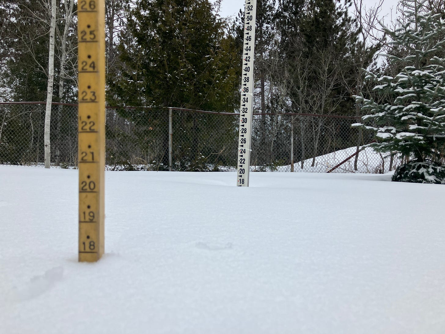
Above: Tamarack location on the ground snow 2.29.24 measurement
This weekend into early next week weather will be pretty quiet with temps in the 40s on Friday, Sat, and rising into the 50s on Sunday as a result of some southerly winds. Sunday and Monday rain looks like it will make its way into the UP with a slight chance of some mixed precipitation on Monday, a few traces of snow overnight possible. By Tuesday we should see temperatures dipping slightly to the upper 20s as winds start shifting back to westerly and northwest, with 15mph north winds by late Tuesday into Wednesday, gusts up to 25mph. Mixed precipitation is likely and a good chance of some lake effect snow late Tuesday into Wednesday as those north winds pick up moisture off Lake Superior.
Will this hold enough to affect the UP much, we shall see as the next few days go on, as we know things can change pretty quickly here in the UP.
March can give us some nice snowstorms, but this year the chances that happens are pretty slim.
Above you can see the current on the ground analysis as of today. Then take a look at the graphic from a couple days earlier for snow cover. You can really see how much of the UP is lacking on snow cover.
Just goes to show you how warm it has been this season.


